Peaks Visible from Calgary, Google Earth
September 30, 2008

This freeze screen includes some of the peaks visible from Calgary with Barrier Mountain to the north and Hailstone Butte to the south.
From the Calgary Tower on a clear day we can see a radius of c. 200 km to the south west, west and northwest. Barrier Mountain is the farthest northwest peak and Hailstone Butte is the farthest southwest visible to the naked eye.
Web 2.0 has provided a number of useful tools for identifying mountain peaks visible from Calgary, situated them within ranges and regions, collecting information about geological formations, associated rivers, creeks, etc, recommended scrambles and hikes, photos, maps, directions and even wild life warnings and wild flower information. Google Earth has been very useful although many peaks are not yet indicated and cannot be found with a regular search. So I have used wikipedia for the larger peaks and when that fails I look to www.bivouac.com which invariably provides exact locations and accurate information on the various peaks. I can use their information to add GoogleEarth icons to my maps. I am also working with Google Maps so I can share a folder with these peaks as I add them. Both Google Maps and Google Earth have their limitations but these are mind-boggling tools for a bricoleuse in virtual cartography.
Although I do most of my work on photos with Adobe Photoshop CS, I prefer to sort and manage photos with Web 2.0 Picassa. It is much faster to work with. Picasa allows me to generate geotags easily. I’m not sure how many programs recognize this yet. Of course Google Earth does. But I have really made quite a mess with folders in my Google Earth .kmz files because of Picasa.
Adobe Photoshop CS allows me to add lots of metadata including tags, captions, descriptions, copyright notices, etc. I am not sure how many other programs can use the data but I am expecting that this will only expand.
I appreciate Web 2.0 Flickr feature of allowing for pop-up notes on photos which means I can identify peaks without actually embedding text as I do in Adobe Photoshop CS. Images can then be shared without adding textual information that others might not find useful.
How to paint mountains: Geomorphological taxonomy
November 14, 2007
I was never attracted to the paintings of E. H. Hughes while I worked as contract art educator at the National Gallery of Canada. It wasn’t until I lived near his home for almost two years, in the Cowichan River valley area that I began to understand that his work was a highly detailed documentation of plants, trees, geological formations, waterways and marine activity — not an attempt to express the impression of the landscape from a tourist’s point-of-view. The ubiquitous greys of the island from November through March explain the colour-challenged palettes in most of Hughes’ prints. The original paintings are rare since most of them have been sold to a unique collector in Germany. But framed expensive mass-produced prints from the original paintings (which the vast majority of people in the age of Robert Bateman — and more recently high quality giclee1 — mistake for original works of art) are prominent, particularly in the places like the family restaurant in Duncan called the Dog House.
In Canada plein art painting in cold weather is possible but uncomfortable. This small acrylic plein air sketch was painted in a couple of hours on the windy escarpment at Edelweis Point. The larger version will portray the mountains more accurately. I often find myself fantasizing about knocking on doors of stranger’s homes-with-a-view to ask for three hours of air space to paint in the off seasons. Following in the paths of plein air painters I had made up my own rules that I followed for decades. I would not paint from pictures. But I moved a lot since then. Each new Canadian region offers new visual opportunities and challenges for painting. Even the qualities of light itself, its clarity, luminosity, is different from region to region. I spent a lot of time studying the patterns of waves on the coast of Vancouver Island. Now I am confused, overwhelmed by the mountains. I want to hike their trails and see them from as many angles as is possible with easy 5-hour scrambles. These days I take digital photos on our day trips in and around Calgary to ecological reserves, public parks or even roadside in Cochrane, Canmore . . . Now I find myself painting with a laptop open beside me so that my finished painting becomes a visual tool for memory work, another way of living in and visualizing my everyday world. I also used to feel that selling mass-produced prints was dishonest and deluded an ill-informed public. Now I am just happy to have available images whatever their source or quality to compare and learn: Flickr, Google images, Virtual museums like the National Gallery of Canada’s, reproductions, etc. There aren’t any overpriced framed Giclees of specific mountain peaks from our local shopping mall galleries hanging over the sofa at home, but I will study and compare them as another way of seeing.
As I refine tags and folksonomy in the virtual world, I seek out more precise multidisciplinary taxonomies in ecosystems I inhabit. It informs the way I see, and the way that I take photographs and paint plein air. I tag my images through Google Earth, Picasa and Flickr. Adobe Photoshop provides tools that allow me to enhance or layer some images. Using www.bivouac.com, Peaks of the Canadian Rockies, and numerous other maps, images and texts I can hyperlink each mountain peak to its exact longtitude/latitude coordinates in Google Earth (and or Picasa and Flickr). In Google Earth I can link the altitude tool relative to space/ground with the height of the mountain. I can also link customized image icons and detailed information including the exact www.bivouac.com and/or Peaks of the Canadian Rockies urls. The process of social tagging or folksonomy fuels my interest in searching for the names that provide the most accurate historical, ecological, geographical information about mountain peaks, glacial erratics, medicinal plants, post-contact plants . . .
Google searches before and after help refine our understanding of the places we have visited. Public librairies, local museums and even Tim Horton’s customers provide more suggestions. Sharing using one of our many social networks is easy. Flickr provides tools for describing and commenting on details of images, adding textual information as well as refined folksonomy, geotagging and comparing photos with special interest groups. Google docs archives the unpublished notes, annotated webliographies and bibliographies and keeps track of published blogs.
In the process I learn about contributions to Alberta’s history by individuals and communities descended from First Nations, Chinese, Italians, French, Irish, British, African-Americans . . .
Of course it is a visual form of memory work. If we only relied on the printed word for knowledge claims we would find ourselves with limited perspectives provided by experts in exclusive academic disciplines who claim that their magisteria is nonoverlapping.
This is changing so rapidly in a world of integrated management. Ecohydrology combines the fields of ecological processes and hydrology that informs integrated management of watersheds. Google Earth allows nonexperts to view climatic zones, mountain ranges, massifs, river valleys, individual mountains, hillslopes, stream channels, estuaries, gullies, barchannels, recharge areas, and in some cases meter-sized features. We can fly over and zoom in on the watershed of the Athabaskan Lake and River, Fort McMurray, Fort Chipewyan. We can read related reports online and track changes ourselves. This kind of information has never been easier to collect and share.
The most accurate scientific information from legitimate sources provides exact terminologies and taxonomies2 that not only clarify complex issues, they are also folksonomy-friendly.
Footnotes
1. Limited edition archival prints where the editions are limited to a hundred or less of an original work of art and hand autographed by the artist are priced accordingly and were considered to be art collectors items. Robert Bateman is well-known for his high-priced multiple edition prints of his popular wildlife paintings. These are often purchased for a hefty price by uninformed collectors who believe they have an original work of art. With progress in digital technologies, printing inks and processes, giclees from original oil paintings can be printed on canvas that appears to have a varnished finish and priced as much as a unique original painting. Giclees on high quality water colour paper do have an archival life of over a hundred years. Their production is costly so they are priced more than a mass-produced print. Giclee archival prints are a huge improvement over the prints of the Group of Seven and Emily Carr distributed to public schools in Canada in the Post World War II years. Most of these framed prints which unfortunately still hang in public places over fifty years later, have darkened and have lost all semblance to original colours.
I now fully embrace the giclee concept as a way of sharing visual information more widely. It is yet another take on Walter Banjamin’s mechanical reproduction.
2. I looked to wikipedia under geomorphology to find the equivalent of taxonomy for mountains that I have been using to identify wildflowers, medicinal plants. According to wikipedia, “Different geomorphological processes dominate at different spatial and temporal scales. To help categorize landscape scales some geomorphologists use the following taxonomy:
- 1st – Continent, ocean basin, climatic zone (~10,000,000 km²)
- 2nd – Shield, e.g. Baltic shield, or mountain range (~1,000,000 km²)
- 3rd – Isolated sea, Sahel (~100,000 km²)
- 4th – Massif, e.g. Massif Central or Group of related landforms, e.g., Weald (~10,000 km²)
- 5th – River valley, Cotswolds (~1,000 km²)
- 6th – Individual mountain or volcano, small valleys (~100 km²)
- 7th – Hillslopes, stream channels, estuary (~10 km²)
- 8th – gully, barchannel (~1 km²)
- 9th – Meter-sized features”
Creative Commons reference:
CC Flynn-Burhoe, Maureen. 2007. “How to paint mountains: Geomorphological taxonomy.” >> speechless. November 13.
CC Flynn-Burhoe, Maureen. 2007. “How to paint mountains: Geomorphological taxonomy.” >> Google docs. November 13.
NB: This article is supposed to be automatically re-published on speechless as changes are made in Google docs. I prefer to have both references available.

The industrial-size cries of the young heron reminded me of scenes from Jurassic Park. Their loud squawking can be heard long before you can see them. The activity in the nest is so aggressive and loud you would think an eagle was attacking. The huge nests balance on the tops of alder trees. This active rookery of about 50 nests is situated at c. 48°44’21.80″N, 123°37’38.78″W. On June 17, 2007 the young were visible with the naked eye. They are awkward and seem to be over-sized for their nests which sway as they fight over food that the adult heron bring.
As we chatted we could see a steady stream of herons flying back and forth between the food sources at low tide on the Cowichan Bay estuary and the rookery at the edge of the ravine that cuts deeply behind Pritchard Road. Dell Bumstead’s mature, magical garden is at the end of Pritchard just on the edge of the ravine. Dell remembers when one flock of seventy heron flew over her garden c. 1997.
Taxonomy, empty lots, roadsides
June 20, 2007
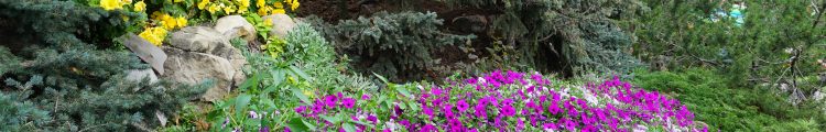
Louise was breathless with excitement and it didn’t help that Reba was pulling at the leash. As usual I was on my knees pulling out Swamp grass and clover from around the heather. She was so proud of her beautiful Labrador Retriever who had just found a trail hidden among the overgrown bushes at the end of an empty lot off Wilmot Road. It was just a few minutes from our hill-side homes overlooking Cowichan Bay. The lot was not really empty as it was completely overgrown with clover, daisies, Swamp grass, wild
blackberries and dozens of other plants many of which I had been battling as weeds for the last 18 months in the garden. Here they flourished and were stunningly beautiful swaying in the breeze.
Suddenly the quiet was broken with industrial size squawking. It reminded me of the sound of raptors in Jurassic Park. As we zigzagged through patches of thorny plants we could see huge heron nests that seemed to be balanced precariously atop Alder trees that were too thin and fragile for this weight and responsibility. The loud squawking seemed to increase and decrease in lulls which I thought at first was due to our arrival or maybe even an attack of an eagle. But as I stood silently watching I could see the adult herons incessantly leaving the nests and returning with food for their offspring. The young were rowdy and ungainly and the branches thrashed as they competed for food. One graceless young heron perched precariously on a branch that bent and swayed under his weight.
All around us underfoot were trunks of trees cut long ago to clear the land to the edge of this ravine tucked in behind Pritchard. The ravine meanders with branches leading into Cowichan Bay estuary somewhere near Wessex Inn.
Roger Tory Peterson1 reminded us that the majority of flowers that grow in vacant lots and along roads in North America are aliens. Hundreds of waysi
de plants came from Europe. Some came from gardens but most came unseen as seeds mixed in with shipments from across the sea. The first known station for a foreign plant is often at seaports or along a railroad track. In the prairies certain flowers came at first to airfields. In 1968 Peterson had already noticed that the best place to find remnants of the disappearing prairie flowers was along the railroad right-of-way. Roadsides are relatively poor because of mowing and plant-spraying operations. Even coastal marshes have lost their flowers through ditching and draining (1986:x11).
Flowers are rooted to earth, often separated by broad barriers of unsuitable environment from other ‘stations’ of their own species.
“Therefore over the centuries, subtle differences have often developed with strains that are so marked that botanists have given them varietal names. Others are ignored because they would overburden an already complex taxonomy. Or a flower, from the same seed, may be depauperate in a sterile soil or where lack of competition has favoured it in some way. Familiar flowers than can look unfamiliar. Some hybridize (Peterson 1968:xii).”
“What of the future of rare native wildflowers? Because of the attrition of habitat, some are in a precarious position. Bogs along the southern margins of glaciated country are becoming fewer and orchids requiring bog conditions are harder to find. When a forest has been cut, its shade-loving orchids may also disappear, and half a century or more may pass before succession makes the forest suitable again for them. How can they return? […] Can seeds remain viable in the soil for half a century or more, until succession renders their habitat suitable again? We know little about this (Peterson 1968:xii).”
We entered the trail that Reba had shown us and there was a third space of semi-tropical rain forest. This hidden treasure is tucked
away in the village of Cowichan Bay. A small stream, that dries up in the summer, winds through this hidden ravine. It is a corridor of towering douglas fir, cedar trees and arbutus trees with dense foliage that is tucked in between developed areas on either side. Sword and maiden-hair ferns and a wide diversity of wildflowers grow in the cool, moist mini-ecosystem. A few villagers have maintained a trail with an almost invisible entrance at the end of a clearing on Wilmot. I am not sure that it is precisely located on the Flickr map but the coordinates are (48°44’23.86″N, 123°37’39.45″ W).
This is linked to my Flickr and to my Google Earth Community and will be linked to Youtube, Facebook and Google Video.
Notes
1. I usually try to separate my own phrasing from that of an author whose works I am citing. In this case these words are a blend of direct quotations from Peterson’s Introduction and my own editing to shorten and summarize. His phrases and wording are so exact, poetic and appropriate that I wanted to enhance their metaphorical quality by keeping them intact. If I included all the “” the result would be too cumbersome.
Bibliography
Peterson, Roger Tory. 1968. “Introduction.” in Peterson, Roger Tory, McKenny, Margaret. 1968. A Field Guide to Wildflowers of Northeastern and North-central North America: A Visual Approach. Boston: Houghton Mifflin.
Peterson, Roger Tory. 1968. “Survival.” in Peterson, Roger Tory, McKenny, Margaret. 1968. A Field Guide to Wildflowers of Northeastern and North-central North America: A Visual Approach. Boston: Houghton Mifflin.
p. xii.
Flynn-Burhoe, Maureen. 2007. “Taxonomy, empty lots, roadsides.” >> Speechless. June 18.
Flynn-Burhoe, Maureen. 2007. “Taxonomy, empty lots, roadsides.” http://docs.google.com/Doc?id=ddp3qxmz_304fp4w32 June 18.


